What is MIMS Mobile Lite
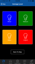
MIMS Mobile Lite was developed to allow you to deploy most of the MIMS Mobile functionality to mobile devices that are either Android or iOS based. Starting with MIMS version 2018.2, you now can leverage your existing MIMS configurations and deploy them to mobile phones and tablets. If you’re already utilizing MIMS, your existing run-time compliant data is already formatted for use in MML as are your existing inspections, (Excluding Redlines), and it’s included in your current ELA. In addition, MML also contains custom base-map support in either Tile Packages (TPK) created in ArcMap or Vector Tile Package (VTPK) and Mobile Map Package (MMPK) formats created in ArcGIS Pro. While the device is connected you can also utilize any of Esri’s standard base-maps.
MML was developed utilizing Xamarin to enable the use of a single code base and to provide the user with native functionality and user experiences. It is compatible with Android version 4.4.x (KitKat) or later, with a minimum API level of 19, and a minimum of iOS version 9. Latest versions of both are recommended.
App Deployment Options
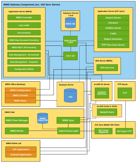
MML takes advantage of an existing MIMS Mobile installation, utilizing MIMS Gateway functionality, and the MIMS Configuration tool. The configuration tool provides a simple user interface for configuring what your field worker sees, and also utilizes the same configuration group concept used in MIMS Mobile, which provides for offering different views of your data as well as functionality to different audiences. It is also now much easier to give access to foreign or contract crews who bring their own devices.
Deploying the actual app to your field workers involves coordination with SSP to provide the correct version that matches your environment. For both iOS and Android, the application can be made available through a private app store or your own internal Mobile Device Management System (MDM). In addition, you can choose to host the Android version on your local servers.
For deployment of MML through a private App store you must first register your organization. For iOS the first step would be to create an Apple Business account and then register for the Volume Pricing Program (VPP). Details for the program and how to register can be found here, https://www.apple.com/business/. For Android, additional information on managed Google Play account can be found here, https://support.google.com/googleplay/work/answer. After registering using either or both of these options you will need to contact your SSP project lead with your Apple ID or organization id from Google. We will then deploy the correct version to your account
The following table illustrates the different deployment option capabilities for the various methods.

If utilizing an MDM the only requirement is that you contact SSP so we can provide the correct version of the APK for Android, and/or an IPA file for iOS.
Customizations

As with our full MIMS product we also can provide customized forms which greatly increase field worker efficiency when collecting inspection data. These forms are XAMl driven and provide a simple workflow for your users, driving them through the data entry process.

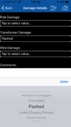
Forms customization will still maintain the native UI for things such as date pickers and drop downs.
Solution Deployment
To deploy the MML solution at your organization you would need to have an existing MIMS solution in place that is running version 2018.2 or later. No additional server infrastructure is needed to support the use of MML. The only requirement for licensing would be enough Esri named user licenses to support both your MIMS Mobile and MML users as Esri requires a named user license for all users accessing your run-time content. Esri typically provides these licenses in packs of 25.
In addition to licensing, the devices that you wish to enable will also need to connect to your network for an initial download of configuration files, the run-time content and any additional base-maps that you may have. Once this initial download is complete the user can work in a completely disconnected environment in the field and upload any data captured when back in range of your wi-fi, or can stay connected in the field if you have provided VPN access.

For latest information and updates login to MIMS Portal or contact us directly to get started.


What do you think?