SSP Innovations is pleased to collaborate with Laura Giboo – GISP, Senior Analyst Geospatial Technologies at Lincoln Electric System (LES). Laura has spent four years at LES working on a number of different GIS projects and initiatives ranging from database restructuring to web and mobile GIS implementation. In her free time, you can find Laura enjoying the outdoors and attending sporting events in and around Lincoln.
Introduction
Lincoln Electric System (LES) has been a long-time Esri GIS and ArcFM Solution™ customer, using many of these software offerings throughout their utility. Historically business users used thick client applications like ArcGIS Desktop, ArcReader, and ArcGIS Engine to view and analyze the utility’s network information. As LES saw the GIS industry evolve, they knew they needed to transition this architecture to the Web GIS paradigm with the latest web and mobile technologies provided by Esri. SSP Innovations supported this effort by performing user requirements and workflow reviews and, ultimately, creating a roadmap for how LES could transition their legacy applications and uses towards the new ArcGIS platform technologies.
Existing Environment
GIS has been a critical part of the utility’s business for a number of years at LES. Due to this importance, LES historically had users accessing GIS information using several thick client applications and customizations including:
- ArcGIS Desktop/ArcFM™
- ArcReader
- ArcFM™ Viewer for Engine
To support the viewing and querying needs of their users, LES had also developed (using their internal development staff) several customizations to provide advanced search tools and related document access.
While this implementation served the utility for quite a long time, it was problematic in many ways. Firstly, even if a utility employee only needed basic viewing capabilities they were still given a more advanced, “thick-client” GIS tool because that was the only option available for them. Secondly, users experienced some difficulties like:
- Too many stored display or PMF file options for the users
- Maps with a lot of layers, sometimes making the view cluttered
- User Experience challenges because these users needed to learn a new, robust GIS tool
This implementation was also difficult to administer for the GIS group. Each user’s thick client installation needed to be tracked, and if a new version or patch was released then these user machines needed to be updated with that new installer. If a new user wanted access to the data or maps, a software installation on their machine needed to be scheduled and completed, which made it more challenging for users to start viewing data. If symbology changes were needed or new data needed to be added to an ArcReader PMF file, that required the GIS group to update and then republish that MXD to the file share accessible by the users.
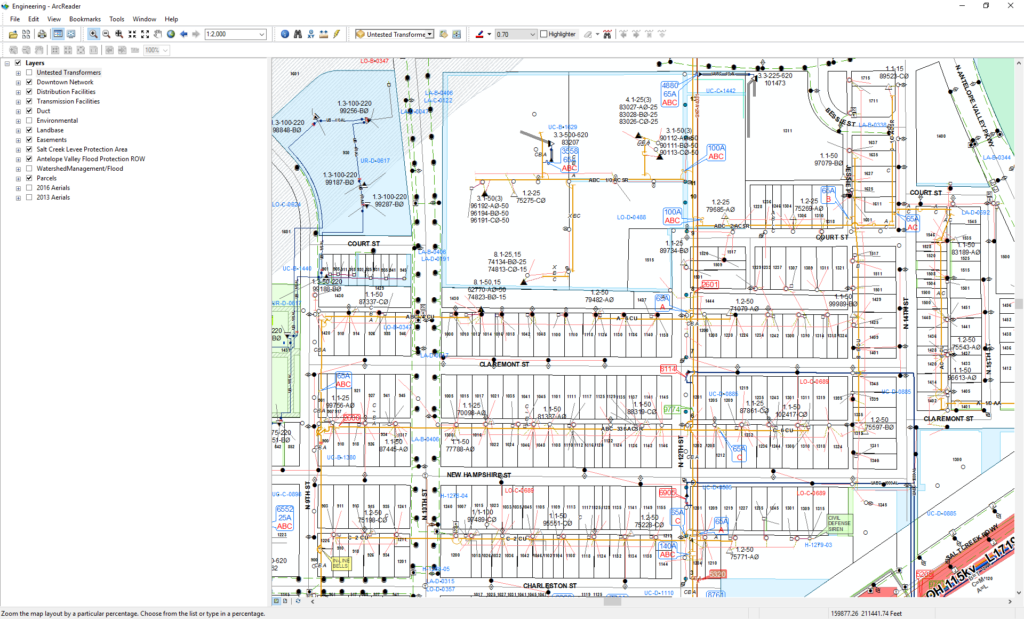
An example of an engineering map viewed in ArcReader
Given the latest Esri technology available with the ArcGIS platform, LES began to realize that a movement away from thick client applications towards a Web GIS was what their utility needed to expand the usage of GIS throughout their organization while reducing some of the administration headaches they were experiencing.
Requirements Gathering and Architecture
Seeing the challenges and needs from their existing implementation, LES partnered with SSP Innovations to create a GIS Roadmap for how their utility can transition to using more web and mobile technologies. This GIS Roadmapping process started with a detailed requirements and usability analysis with a number of user groups throughout the utility including:
- Planning Engineers
- Field Engineers
- UCD/URD Designers
- Land Management
- Mapping/GIS Technicians
- Locating Field Crews
These interviews and workshops identified a common set of needs that each user group said were key requirements for this new architecture. These included:
- Simple querying capabilities – Easy ability to find an asset and the information associated with it, to efficiently perform work.
- Aerial Imagery/Street level imagery – Easy access to this type of imagery would allow LES users to get a better perspective of projects from their desk allowing more work to be done in the office while reducing site visits.
- Map Performance and Readability – Users were used to a highly performing map and expected the same level of performance through a web browser, regardless of density of data displayed.
- Simple Administration – Given the amount of time the Geospatial Technology staff spends administering the current implementation, having the future solution be simple and straightforward for users to access and administrators to manage was a high priority.
As a result of these customer interviews and workshops, SSP Innovations created a GIS Roadmap for Lincoln Electric System which outlined a recommended architecture to support the user needs of how LES could optimize the user experience of the portal, map services, and web maps they were authoring, along with considerations for mobile technology usage.
Installation, Configuration, Deployment
Now that the user requirements had been gathered and the implementation recommendations were documented the next step was to install and configure the system. SSP Innovations worked with LES to implement a single machine ArcGIS Enterprise deployment using Chef. This installation also included the configuration of the Model Organization for Electric Utilities solution template along with introductory web maps including:
- Electric Distribution – The foundational web map allowing users to see all of the important electric distribution locations and assets. Users are also able to add in additional service items if the data that they are looking for is not in this web map.
- Land Management – This web map highlights parcels, lot lines, easements, and other pertinent information for the Land Management group. Also in this web map, are links to the county accessor’s site which the Land Management group utilizes daily.
- Electric Transmission – This web map highlights important electric transmission locations and assets. Users are also able to add in additional service items if the data they are looking for is not in this web map.

The LES Land Management Viewer web application allows easy access to Land Management related information
LES was also able to support a number of their legacy, desktop focused customizations using out-of-the-box (OOTB) Esri Widgets. Two specific examples of this were replacing the LES “Super Search” tool and providing the ability to view document links for construction drawings and easement/contract legal documents.
For the Super Search tool, using a combination of the Esri Search widget and Esri Query widget, LES was able to provide the same level of functionality using OOTB configuration. One benefit was that users who had historically used the ArcReader maps did not have access to the legacy customization, meaning with the web implementation, they now had more functionality because they could access these search and query tools in the new web maps and apps.
For document access, users can now just click on certain features where hyperlinks are configured to show within the popup. This is especially useful for users needing access to documents related to network design, construction and as-building or legal documents pertaining to easements. This configuration was done using the URL Parameter capabilities in Esri Web Maps. Those URL parameters pointed to a Microsoft Sharepoint site LES uses for document management. For a more detailed overview of how to configure pop-ups using URL Parameters, check out this blog.

URL parameters embedded into pop-ups provide easy access to documents related to a location
Once preliminary versions of the web maps were up and running, LES smartly put together a beta program to have individuals within the utility try out these new maps. LES started with a basic GIS Web Viewer Map that closely mimicked the most commonly used map in ArcGIS Desktop and ArcReader. A group of eleven individuals from various work groups were given access to the map initially. Some of the beta users were individuals who currently use ArcGIS Desktop and were used to the fully functional tools and customizations that this application provided. Other beta users were current ArcReader users who have asked in the past for more capability within their map. In having a wide variety of beta users, LES was able to gauge whether the web maps were still useful for those that were used to the full functionality of ArcGIS Desktop and whether or not the web maps fulfilled the needs of the ArcReader users. After two weeks of beta-testing and tweaking the web map based on user feedback, LES was able to roll out their GIS Web Viewer map to additional work groups. Because the beta testing and initial release of the map went smooth, additional maps have been created (a Land Management Viewer and a Transmission Viewer) since then, to target some of the smaller, more specialized work groups at LES.
Initial User Feedback and Future Plans
LES has had their new Web GIS deployed for two months now and the feedback has been very positive. The need for a thick client install is now significantly reduced, and users have easy access to the portal and the associated service items, web maps and web apps that are available. Specific user feedback has included:
- Map performance when loading, panning and zooming is much faster
- Users like the search functionality
- Users like the flexibility of adding additional data to the base map service. Portal administrators have created new service items which link to the City of Lincoln, Nebraska city services for users to bring into their maps.
As with any new implementation, there have been a few challenges too. The main one has been how to optimize the amount of data being presented in a single map service to fine tune the user experience.
One major benefit for the administrators has been that they now only need to make map service and configuration updates in a single place (ArcGIS Enterprise) and no longer need to concern themselves with application installs and version updates. This has significantly reduced the administration overhead on the GIS group.
LES is already looking towards the future with multiple initiatives to expand the capabilities and usage of their Web GIS throughout the organization. First on the list is making sure their platform is architected in a highly available way to support the growing needs of their users. Secondly, they are looking to make more web maps available to their users. These web maps will be based on the different ArcReader PMF files that were published and managed in the legacy implementation, with the goal of consolidating and improving the maps wherever possible. Other key capabilities on the horizon include making electric network specific tracing available to Web GIS users in their web maps and apps and moving content from ArcGIS Online to ArcGIS Enterprise so that data does not need to be copied up to the cloud. LES will also be looking closely at the new capabilities released with the ArcGIS Utility Network Management Extension along with Esri Partner offerings as well when considering how to deploy tracing to their users. Further down the line they will be looking into ways to develop their own, LES specific widgets to support their utility workflows.
LES has made a major step in the transition from being a Desktop GIS focused utility to implementing and embracing a Web GIS and the ArcGIS Platform. SSP Innovations has been honored to work closely with them throughout this process, and is looking forward to seeing them continue their success with this transition.

What do you think?