
Over the past several months we’ve been writing articles detailing how ArcGIS Online can be used to change and enable a utility’s workflows. This month we will continue that theme by looking at how ArcGIS Online can be used for customer engagement. Esri talks about customer (or more often citizen) engagement as being one of their five patterns of GIS that make up a complete, integrated GIS. Esri says the following about citizen engagement:
For a dependable, accurate foundation for your citizen generated data, build apps based on your authoritative data. Then make sure those apps work seamlessly with existing GIS workflows, which ensures that the data you collect will work with back-office systems and prevents citizen data silos.
The concept isn’t new by any means but we now have some pretty cool and cost-efficient patterns to implement it with ArcGIS Online. As with most of our articles, we will demonstrate the approach with a simple use case we have implemented at several utilities – a public facing Streetlight Outage application.
The goal of this application is to allow customers to easily report streetlights that are out in their communities and to have the utility respond quickly and effectively. There are entire 3rd-party companies out there that build these streetlight outage apps on top of Google maps and other platforms and in the past SSP has been asked to support these implementations by providing monthly exports of data via shapefiles or other similar integrations. But now with ArcGIS Online we can easily build out this scenario quickly and provide support for every major device platform on the market.
 I’m going to use a similar architecture to my Pole Inspection article including an ArcGIS Server mapping service of all the streetlight pole locations along with a feature service to allow for the addition of new streetlight outages. I’m not going to go into the detail of setting up the ArcGIS Server services here OR setting up the ArcGIS Online webmap since this is almost identical to the pole inspection example. Check out that article if you want to learn more about the approach.
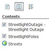
Here we are going to jump right to publishing my webmap. I will call the map something meaningful like “SSP Utility – Streetlight Outage” to make it easily searchable in ArcGIS Online. I will then share this webmap with everyone:
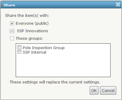 The reason we are sharing it with everyone is so that our customers can enter data into this webmap via the public internet. They will not need to be subscribers to ArcGIS Online. And to prove that point I am going to demo this scenario using my iPhone without being logged into my ArcGIS Online account. Ideally you would post something on your public website informing customers that this webmap is available via the Esri application, and/or you could include an ArcGIS Online webmap embedded directly into your public website. Either way, the customer can easily get to the map.
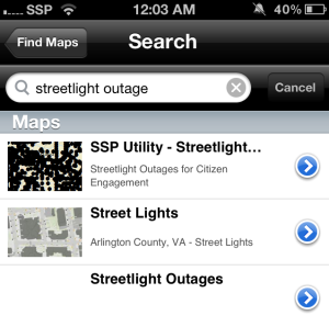
For my use case I first load up my Esri iOS application and just do a quick search for “streetlight outage” which returns a few results:
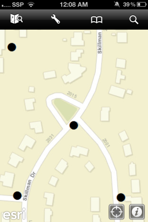
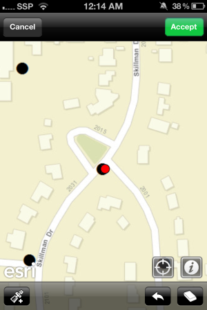
I click on the SSP Utility – Streetlight Outage webmap to load it. I then walk outside to the streetlight that is out on my street and click the GPS button on the Esri app to zoom me to that location. I note that there is a black circle indicating a utility-owned streetlight at that location:
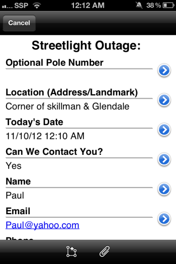
Now I use the tools included in the Esri app to place a new streetlight outage. We’ve chosen to collect data including an optional pole number (for the overachieving customers), a location description in case they don’t place the pole at the exact location on the map, the date, and some optional contact information for the customer to allow the utility to follow up:
We can even grab a quick snapshot of the streetlight pole using the camera on our phone:

And finally we can place the outage on the map by clicking the location or using the GPS location:
The key here is that we are making it EASY for the customer to submit data to the utility using their existing mobile device with an intuitive application. This will encourage our customers to use the application to provide this data to us. BUT we can do even more…. the streetlight outage records are being transmitted to our back office GIS in real time via ArcGIS Server. We can then use batch services to monitor this process so we can automatically trigger some events whenever a new outage record arrives from a customer.
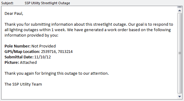
First, we can score a lot of points with our customers by simply acknowledging that the information was received. If they provided their email address, it’s as quick as sending them a short email:
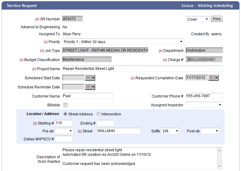
 And finally we can use a quick geoprocessing task to get the actual streetlight record from the GIS including the pole number, lamp type, original date installed, etc., and can then submit an automated work order into our work management system to queue the repair up for scheduling. In our example we have integrated this workflow into SSP’s Workforce Management product:
And that’s what we call an automated workflow! It all happens without any effort/cost to the utility while customer satisfaction soars because they have been able to communicate effectively with the utility using the latest and greatest technology (their smartphone) AND they received an immediate response. All that’s left is for the utility to complete the work in a timely manner. Assuming we do that successfully within a week, the process improvements will be completely apparent to both the utility and to the customer.
This example embodies the practical definition of what customer/citizen engagement is all about. ArcGIS Online now allows us to solve this challenge faster and cheaper than ever before. And as always, remember that this example is just a pattern for customer engagement. It can be applied to many different scenarios. Let us know your thoughts!

What do you think?