The Value of a Simple Geometry-on-Geometry Check
The Utility Network is a demanding data model. Subnetworks are only created in full if the data has the correct connectivity. Critical attributes also need to be fully and correctly populated, such as Pressure, voltage, phase, etc. During the step to prepare for migration to the Utility Network, rules are evaluated, and errors are generated.
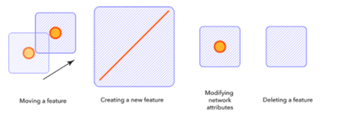
The network topology creates what is called “Dirty Area” errors. Dirty areas are visual markers to detect where edits to feature have taken place, requiring incorporation into the network topology. Features are evaluated to ensure they comply with the feature restrictions and network rules of a utility network. If the feature passes the check, the dirty area is removed, and the network topology is updated. If the feature fails the checks, an error is created.

An error defines where network features in a Utility Network violate established rules and restrictions, such as empty geometries, unknown subtypes, coincident features, missing rules, multiple applicable rules, etc. ESRI has codes for certain types of errors, and each Dirty Area will have in its attribute table the different error codes that occurred. Without prior knowledge, these codes can be tough to decipher, especially when a mix of data errors and missing network rules. When it comes to a complex network of conductors or pipes, there could be multiple errors on one line that are not always obvious to see, such as a duplicate vertex or an attribute that should be matching between features that are touching. This is where data reviewer can show its value; in using the breakdown of error codes, you can narrow it down to a single cause, or by running checks before and cleaning stacked points, you can eliminate the creation of a dirty area altogether.
A great example of this is the Geometry-on-Geometry check for Data Reviewer. It can not only find features that should not be coincident, but it can also look at touching features that should have matching attributes. Specific rules exist for data even outside of a geometric network or utility network; for example and 4 Inch Elbow should most likely be on a 4 Inch main, or a switch with the phase of A should match the conductor it’s on. By comparing the correct attribute on two spatially related features, the data reviewer can find any that don’t match, potentially finding important data errors in a programmatical way.

Configuring checks for fittings and other related point features on a line that needs a spatial and data relationship Data Reviewer can find issues that would hinder a network, subnetwork, or tracing to function correctly. Then, run across the whole database or a specific area and report the accuracy of the data with a minimal amount of effort, making it an extremely powerful out-of-the-box tool to run.


What do you think?