Quickly. Name all 5 Great Lakes.
Sometimes it is funny where blog post ideas come from. On a recent flight, I was sitting next to someone from Rochester, NY. Yeah….I am the annoying “Blabbermouth” as self-described by Del Griffith (John Candy) in Planes, Trains, and Automobiles. Unlucky for her, she was connecting in Philadelphia to go to Memphis, and had to sit next to me.
We got to talking about Rochester. I had once done some Fiber Manager™ work there a few years ago. Every day after work, I would ride my bike from the hotel through Seneca Park to the lake north of Rochester. What gave me the idea for this post was the fact that she didn’t know the name of the lake after living there 20 years.
I have written multiple blog posts on the benefits of the GPS for utility data collection. Lately, these have focused on cell phone applications like Esri’s Collector and Survey123. No doubt that the GPS is an amazing tool. BUT…..Just like a word processor’s spell checker has not helped my atrocious spelling or the calculator has not helped people’s “on-the-fly” mathematics, the GPS has not helped people’s knowledge about where they are in the world.
I first started using a GPS as a consultant for Fort Riley, KS. At this time, the US government was introducing an error (Selective Availability) to the navigation satellites’ transmission that amounted to about 100 meters (328 ft). The only way to remove this error was post processing (differential correction) when back in the office (or utilize a military grade GPS).
When our government removed selective availability on May 2, 2000, real time GPS navigation truly became possible. GPS units in cars took off, scavenger hunts (i.e. Geocaching) became a hit, and GPS navigation to previously-collected GIS features became practical.
When I first started traveling for a career, directions would be printed to get from the airport to my client and from there to the hotel. If somehow I got off my map or directions, I would have to stop and ask for instructions. Although I never mind, it is always interesting asking locals for directions. They often assume you have been there before with statements like, “Turn right a half mile before the fork in the road.” There are also unique units of distance like, “After making the right, it is a hop, skip, and jump to the utility.” Just how far is a hop, skip, and jump? Is that longer (or shorter) than a backflip?
I haven’t printed maps/directions for about 4-5 years as quality phone apps have replaced the need for paper. The only problem is that unless I am working onsite for multiple weeks, I require the stupid GPS every onsite day. When I actually used my mind, instead of being a sheep to the GPS unit, it only took a couple of trips, and the route was known by heart. Beyond the road and when to turn next, most people don’t zoom to see what else is out there.
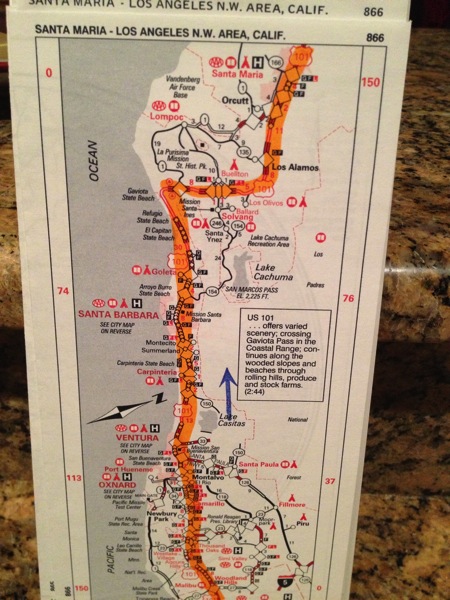
On a side note…..Remember paper road maps? The car club AAA use to print a Trip Tik. The would print a small book highlighting the route with a big fat highlighter. They would also take a stamp to identity construction zones. AAA doesn’t do it like that now. (Note: I am writing this at my mother’s house on a Sunday morning with a cup of coffee in my hand. She woke up, and disputed that statement). Getting the hard copy maps became a pain, and use of AAA now only occurs when locked out of my vehicle or a tow after the introduction of Bambi to the hood of my car.

Inside Philadelphia Airport’s Terminal F, there is a gigantic areal map which illustrates the location of the airport in respect to the City and the Delaware River. This map and Smashburger are about the only nice things I can say about PHL. Inside malls or large buildings/parks, there are maps with “You are here” or maps with the emergency evacuation route. It is good to know where one is.
It is also fun to not know exactly where one is. A fun hobby of mine use to be orienteering. Every Sunday, there was usually a race in eastern Pennsylvania which required one to not only be fast, but also be able to navigate via a topographic map. Unfortunately, my body just can’t handle the pounding of running anymore.
An interesting study would be to to ask people to point to north without Siri. It would also be interesting to compare these results by location. For example, I suspect the percentage of those living on the front range of Colorado would be higher than someone with no major linear landmark (I.e. Nebraska).
In closing…..The GPS is an outstanding tool, but occasionally turn it off and get lost. One just might discover something new, themselves, or their “Garden of Eden”.
ANSWER
The Great Lakes are: Michigan, Superior, Huron, Erie, and Ontario. I promise that I didn’t cheat before typing, but I did verify (so I didn’t look stupid in case I was wrong). For bonus…Did you know the lake north of Rochester? It is Lake Ontario.


What do you think?