I switched to Google Fi as my mobile carrier in January of 2017. I bought one of their phones which lasted 27 months until it broke, at which time I got a replacement through Google Fi that I still have today.
Every once-in-a-while some data privacy scandal shows up on the news where Apple or Google or Amazon has been found gathering data people didn’t think was being gathered. I’ve just assumed a ton of data was being collected by Google as I get Google Maps Timeline summaries from time to time.
I decided to investigate a bit to see what kind of location data I could pull and found it was an extremely straight forward task. The steps are as follows:
- Go to the site https://www.google.com/maps/timeline
- Click on the gear in the corner of the map and click the download option.

- Check the kind of data you want to pull and choose what format you want.

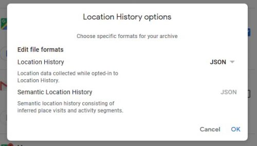
- Wait for the archive to be created.

- Download it from the link received via email.

Now I don’t know who has all this location information being collected on them in this fashion. Is it all Android users? All Google Maps users? All Google Maps users with Google accounts active? Every human with a mobile device? I just don’t know. But I do know it has been fascinating to look back on where I’ve been in the past three years. (Except for that little guy off the Oregon coast, where did that come from?)
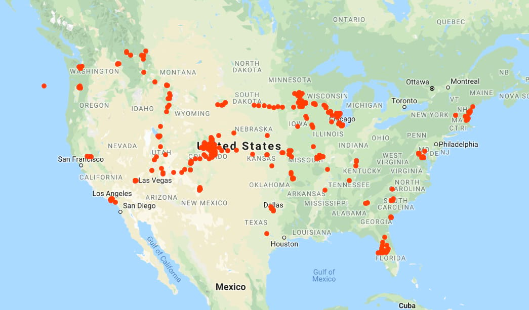
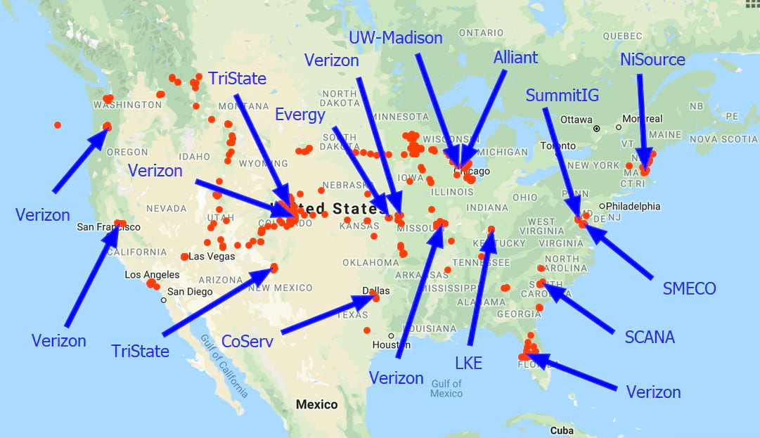
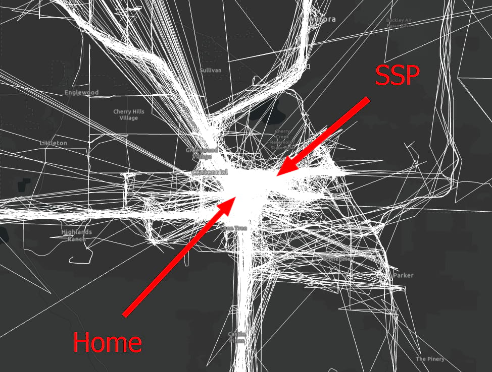
At a glance I can pick out places I’ve gone for various projects while working at SSP:
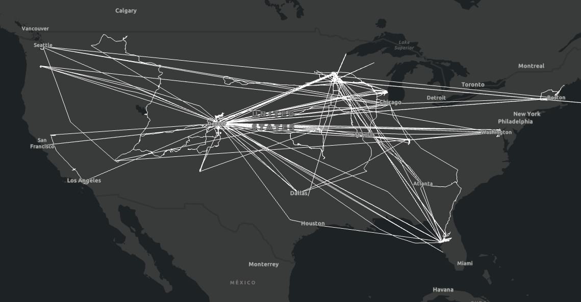
I can pick out road trips I’ve taken (I love road trips):
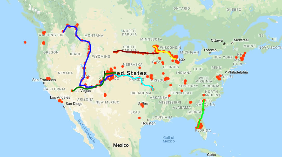
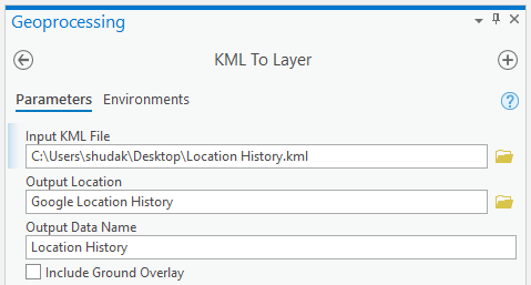
Its also a simple matter of choosing to download the data in KML format which can be turned into one gigantic polyline in ArcGIS Pro with the KML to Layer GP tool:
The level of detail is crazy when one starts drilling down to specific locations.
I’ve lived in Colorado near the SSP office for something like one and a half years now and there are a lot of recorded paths.
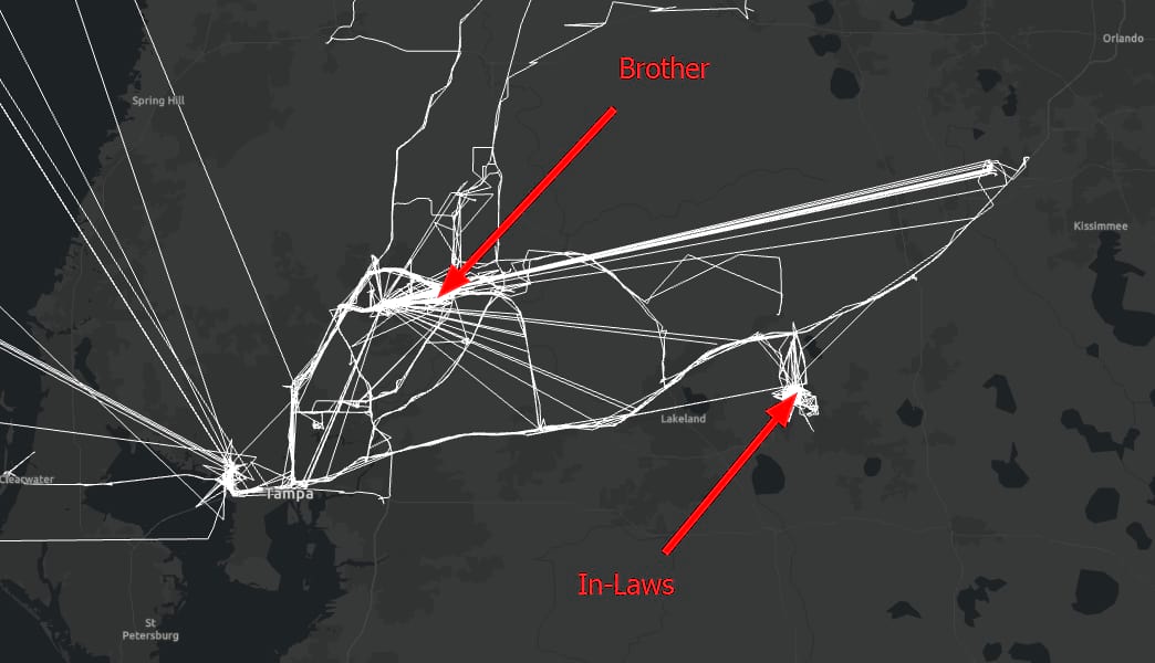
Here is an area of central Florida I visit way too much.
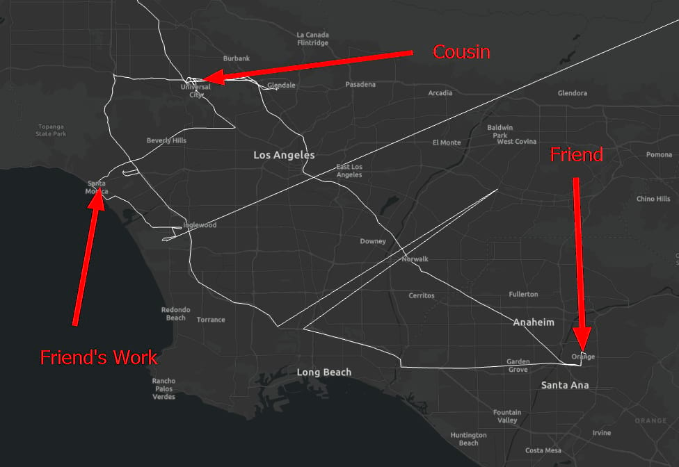
At the end of a client visit in Sacramento a storm was certain to cause a massive delay in my flight, so I decided to drive down to visit my cousin and an old friend in Los Angeles for the weekend instead. Check out my friend’s insane commute working in Santa Monica and living in Orange.
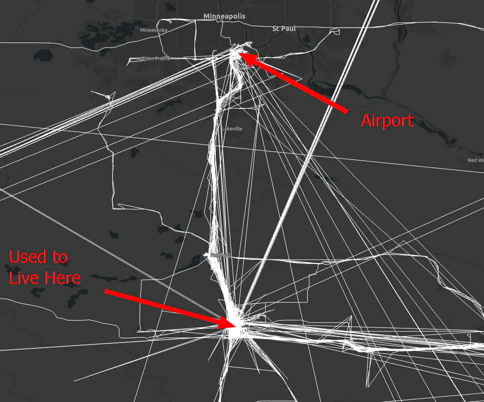
I used to live in Owatonna, MN and I don’t miss the hour-long drive to the airport. I don’t think a more boring stretch of highway exists in this country.
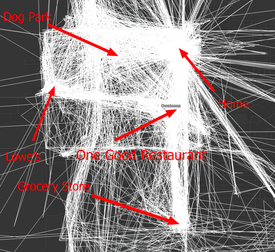
Here is a better view of the town of Owatonna. It was a nice town. I miss that Lowe’s.
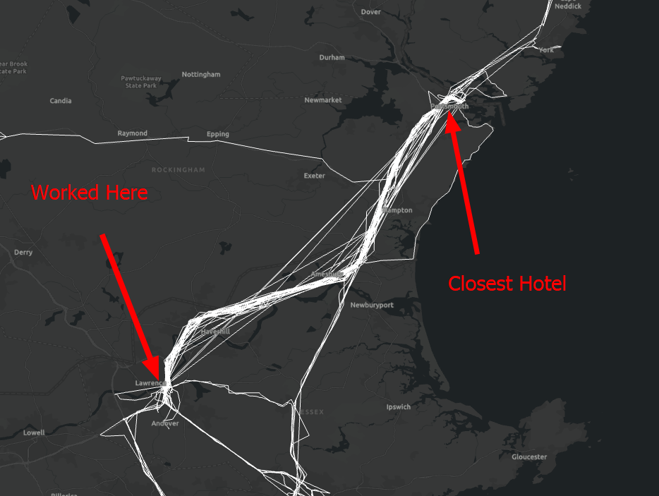
And finally, here is Lawrence, MA. A few of us at SSP went to work for NiSource after a gas over-pressurization event caused a lot of fires. They put a lot of residents without gas up in hotels around the area. Thus, there were only certain hotels we could book. For a lot of that time I stayed in a hotel near downtown Portsmouth, NH which was almost an hour away by highway!
The download is broken down into a “Location History” file and then a file for each month. These are in JSON format. The “Location History” file can also be downloaded as a KML.

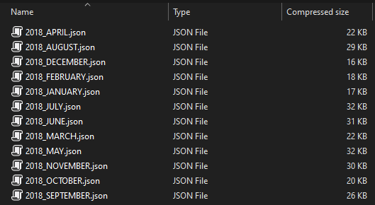
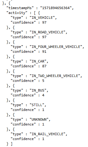
The JSON contains a lot of meta data. There are confidence levels in different modes of transportation along with a timestamp and a coordinate. I think I’ll investigate this format in future in order to parse it out into another format to run some analysis of some kind.
It would be interesting to try to pull out all the times I rode my bike to work in 2019 or something like that. Since I have an electric motor on my bike and cruise at a constant 20 mph (haters gonna hate) I wonder if it thinks I ride around in a four-wheeler?
I found this data interesting and thought someone else would too. It’s still a little unnerving but maybe its just a sign of our times. This exercise is a sort of lemonade from lemons. I encourage everyone to find out what your timeline looks like and what kind of personal meta data is out there. There are also ways to limit what is being collected. At least that is what they say. Dun dun dunnnn.


What do you think?