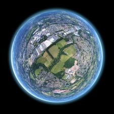
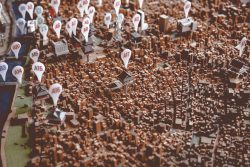
How do you know where you are right now? At the moment, it’s more than likely you are at home, working out of a spare room or a kitchen table. But if you closed your eyes, blocked out the sound around you, what would be the cues that you could use to establish your location? I used to imagine growing up that if you dropped me off somewhere, without any signposts (as I’m sure my parents considered doing regularly) that I would be able to look around and recognize the style of houses as being in Northern Ireland. Or know from the look of a road sign (no language, that’s cheating) that I’d been exiled to Switzerland. If there was a big yellow car, rumbling down a street with steam drifting out of manholes, I’d made it to New York (at least one childhood dream realized).

I would have put a reasonable amount of money on the fact that I’d be most unlikely to consider this philosophical concept in a professional capacity, but life finds a way. One of the more interesting functional requirements that we’ve had to consider on a recent project, is how to identify what area an ArcFM user is operating in, purely from a visual cue on the map. Previously, the customer’s GIS information for each area was held in a separate database, so a mapper could work to the limits of the map in their region – to get to another region, they would need to login to a separate database. Part of the project’s requirements is to merge all the databases together into a single, seamless map – suddenly the mapper’s boundaries have become a great deal larger.ly borrowed.
Culturally, it took a while to come to terms with a mapper based in one place now being able to operate across all of the other regions – that discussion spirals off into a whole new area of organizational change management and how to best manage the deployment of all these new capabilities (call David Miller, he’s the expert). Practically, we were faced with a request from the customer – how do you best show a person where they are on a map when zoomed in tight? After a while spent messing about with Lux-O-Valves and Refracto-Nullifiers and Spectrum-Bypass-O-Matics, we put down our copy of Life, The Universe and Everything and started to look at options like having a new field on the toolbar that displays the current neighborhood for the viewer, or drawing a polygon based on the user’s base work location and crosshatching out (in a nice bright color) any areas not in their home region. I personally advocated for a sound file to trigger every 30 seconds with a “Remember, you are in xxxx” and a flashing red light. Some of these were deemed to be silly, others would have real-world performance impacts.
The elegant solution that was finally proposed and accepted involved creating an always-visible label that pulled from a customer-provided neighborhood data layer, that was set to high weighting and other conflict detection properties, such that it would always be visible, regardless of zoom level. This was coupled with a locator display result that would provide a listing of all features with the same search values (a common issue when trying to co-ordinate data uniqueness across multiple databases) with the neighborhood code added as a suffix. The user could then select the one in the appropriate location and zoom to it. It took a while to get to a solution that balanced the needs of the business with the capabilities of the platform and achieve an optimum trade-off between performance and functionality and it was a pleasure to see a multi-vendor teamwork with the client to provide the needful.
In my youth, I could think of a few times it would have been very useful to know what city I was in when I woke up, I look forward to this overlay feature being available in an upcoming release of smart contact lenses. Next time, I hope to have a look at who decides what a neighborhood is called and where its’ boundaries are, the answers may well surprise you. Stay safe and well, whatever location you are in, familiar or not.
Thanks to Douglas Adams, Michael Crichton and anyone else whose excellent work I have unconsciously borrowed.


What do you think?