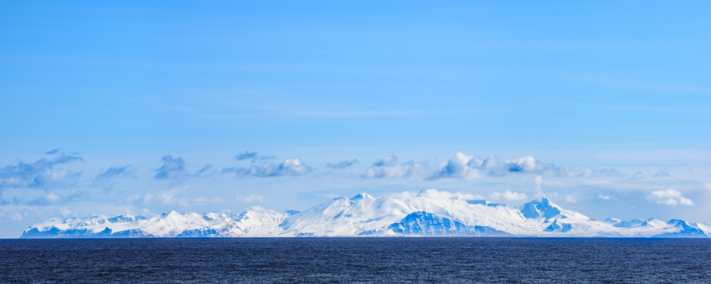
This is a post about a place. A location on the Earth. A geography. A spatial locus. The arrangement of physical matter in a locale. Where, you ask? Unimak Island. Why? Why not.
I found Unimak to be fascinating. As with most places, a little investigation reveals a wealth of interesting geospatial novelties. If you are game, come along for the ride.
Unimak is the largest and first island in the Aleutian Islands chain which makes it part of Alaska. It is the ninth largest island in the US.
I first learned about the island after seeing a picture of some hunters looking absolutely dwarfed by an enormous brown bear they took down. Here is the Google Image search link. The pictures are a little… grizzly, so if you are sensitive to such things just pretend they are all sleeping.
The rich volcanic soil on Unimak from its volcanoes, including Mount Shishaldin (one of the ten most active volcanoes in the world, last erupting in 2004) fuels abundant plant and animal life that helps the bears grow so large.

But the information I found seems to refer to the bears in Alaska with different names. I’ve seen: brown, coastal brown, peninsular brown, grizzly, peninsular grizzly, Alaska Peninsula brown, Kodiak, etc. Evidently, all the brown bears are the same subspecies to biologists except for the Kodiak, which live on Kodiak island and are a bit larger. Otherwise, they are all brown bears.
So, what is a grizzly? The difference between a brown bear and a grizzly is their diet, making them larger or smaller. That comes from where they live. Thus, the coastal bears (including those on Unimak) are much larger because they have things like clams, sedge grass, and salmon to eat. For trophy hunters this means the distinction between coastal and interior bears matter. The Boone and Crockett Club (established by Teddy Roosevelt) has a definition of the dividing line that distinguishes the “coastal brown bear” from the interior “grizzly”:
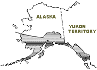
A line of separation between the larger growing coastal brown bear and the smaller interior grizzly has been developed such that west and south of this line (to and including Unimak Island) bear trophies are recorded as Alaska brown bear. North and east of this line, bear trophies are recorded as grizzly bear. The boundary line description is as follows: Starting at Pearse Canal and following the Canadian-Alaskan boundary northwesterly to Mt. St. Elias on the 141 degree meridian; thence north along the Canadian-Alaskan boundary to Mt. Natazhat; thence west northwest along the divide of the Wrangell Range to Mt. Jarvis at the western end of the Wrangell Range; thence north along the divide of the Mentasta Range to Mentasta Pass; thence in a general westerly direction along the divide of the Alaska Range to; thence westerly following the 62nd parallel of latitude to the Bering Sea.
I figured I’d try to create the dividing line based on this description in ArcGIS Pro by dropping points, making a polygon, and clipping Alaska with it. By definition the red area is full of grizzlies while the blue area is full of brown bears. The description mentions Unimak island as the terminus of the coastal brown bear area. You can see Unimak as the last blue island in the Aleutian chain in the bottom left corner of the map. Past that point there are no bears, the red fox being the largest mammal.

Now for a map on the Boone and Crockett Club website:

Pretty close. Accounting for different projections and their more precise path along the divides of the Wrangell and Alaska ranges, I’d say it’s dead on.
In addition to brown bears, the island is home to a bunch of different species of mammals. In 1980 over 900,000 acres were designated as wilderness and is managed by the United States Fish and Wildlife Service.
The caribou, red fox, weasel, land otter, sea otter, sea lion, harbor seal, and human (the most dangerous game) all call Unimak home. About 60 people live on the island, all in one town called False Pass on the very eastern edge of the island. With no native trees growing on the island, the people have planted some Sitka Spruce in town, but those plants haven’t naturally seeded any new trees.

Wikipedia states “Cape Lutke is a headland on the island.” What is a headland? Is that a specific geologic formation? Here is what that looks like:

Another wiki entry describes it as a coastal landform that is usually high, extends into the water, and has a steep sea cliff. If the headland is large, it will usually be called a cape. I think it’s hard to tell from the wiki photo above, so here is what it looks like on Bing maps:

I don’t know if this is very helpful. You can see the steep cliffs and how the land juts out a bit into the ocean. It also looks big, so I guess that’s why it’s a cape.
The economy on the island has been focused on local resource exploitation. Throughout the history of its human habitation, simple sustenance pursuits through hunting, gathering, and fishing dominated. After Russian and other explorers found the island fur trapping became important. In the past century fish canneries and fish exports fueled an export economy.
Fishing for salmon, cod, halibut and crab are still primary commercial activities. Recently trophy hunting and tourism have started to play an important role. Since all the people on the island live in the town of False Pass, and since its population is so low, there is a nice pie chart with exact number of workers per category from the state of Alaska.

A horrible tsunami in Hawaii that claimed 159 lives resulted from an earthquake on Unimak in 1946. The earthquake knocked down a newly build Coast Guard light house on the island, killing its crew. The quake also generated a series of waves that eventually reached Hawaii.
The incoming waves sucked in water from the shore causing many locals, including children, to wander out to the now-dry sea bed. They puzzled over the trapped fish and other sea creatures left stranded out of the water before the first tsunami waves started crashing to shore, catching them off-guard.
Not much else to note. It rains a lot. Like a lot. But otherwise that’s about it. Its interesting to me that as much information exists online as I’ve already presented here. I found an image of a ‘homestead’ claim near False Pass for prospecting but haven’t found much else in the way of mineral resources. Other islands in the Aleutians have gold, silver, copper, and coal. And many have been heavily mined. The first hard rock gold mine in Alaska was in the Aleutians. But I can’t find much evidence of mining on Unimak.
It’s a neat island but there is not much on it that is important to modern human society as is found elsewhere. There are no great ancient pyramids, no large mines, no large population centers, no hubs of transportation, few people, and few visitors, and no shopping malls. Sounds like somewhere I would like to live.


Peter Kaufma says:
Hi STephen:
I just wanted to write to say how much I enjoyed your description of unimak island. I’m a writer here in Cincinnati and am working on a book pertaining to the 1946 tsunami that destroyed the scotch Cap lighthouse.
Thanks again for posting this.
Cordially,
Peter Kaufman
Ira stolzenberg says:
I spent 3 months on the island in early 1971. It was the mosT rugged place i had ever been in my like, especially since i grew up in brookLyn. I was based out of cape sarichef and made the transit to scotch cap lighthouse several Times. Like being on the moon.
Brian smith says:
Enjoyed your piece on unimak is. Im working on a book about a native aleut man from the island who was in the battle on attu. If you have any more info on unimak (or other is.) Please send along & ill put you in the bib. Thanks.