
Coming off the 2016 ESRI User Conference last week in San Diego, we continue to see a major push in the GIS space to utilize mobile and/or web applications to access, collect or update data. How can pipeline operators use these tools as a GIS system of engagement to update our system of record? As described in SSP’s previous Survey123 post, Esri has a new product to do just that.
Old manual and paper field collection workflows can now be a thing of the past and easily implemented on any mobile device, integrated directly back into your GIS system of record and readily available to the organization across the Esri platform. It historically would take weeks or months to get data from the field back into the GIS system, if it ever got entered in!
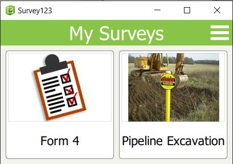
We see Survey123 as an application to support multiple pipeline workflows including: bell hole inspections & pipeline excavations, anomaly verifications, foreign line crossing reports, encroachment reports, environmental reports, maintenance activities and more.
Think of anything you currently collect in the field on paper and this can now easily be an integrated workflow on a mobile platform of your choice, logically scheduled/deployed to field users, updated in the field, pictures or documents attached and published directly back into your enterprise GIS. Sounds great doesn’t it?
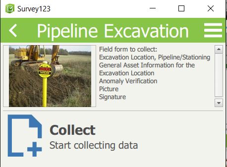
After years of piecing these workflows together and building custom applications, it sure does to us. This blog supplements our previous post, but dives into how pipeline operators can set-up and utilize this new technology to streamline existing workflows. Today…its pipeline excavations.
Typically, a client’s pipeline excavation form is at least 6 pages and we’ve seen well over a dozen pages to support this activity. There are sections that range from general information about the dig site, pipeline characteristics, anomaly verification, soil/environmental characteristics, coating observations and more.
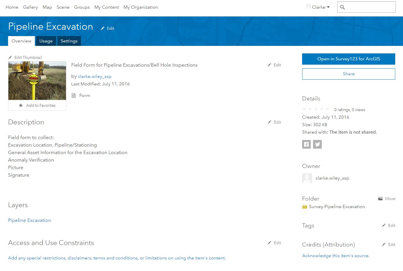
This one form will ultimately have data that resides in a series features and attachments. Survey123 will now allow us to collect this data in the field and logically publish it back to its appropriate features in the enterprise GIS environment.
Think about how this was collected in the past and see how then see how easily this can be implemented moving forward. As the regulatory landscape continues to expand, a tool like this will greatly support your ability to satisfy the Verifiable, Traceable, Complete and Reliable requirements. So how do we set this up?
In this example, we will create a mini-excavation form that includes fields for generic pipeline attribute, anomaly verification/characteristics, capture a picture at the location, signatures and publishing back to the enterprise.
Survey123 Connect is the desktop application (fully released in June 2016) used to create and configure the surveys for the field collection. XLSForms are being used to configure the forms, fields, entries and others. Most commonly XLSForms are created in Excel, but Excel is not a requirement if you want to import a finished configuration into Survey123 from other source platforms.
For our purposes, we have used Excel for a common application we all use, while Esri has also provided a number of example templates and online help to configure these forms.
In our pipe excavation example, we started a new survey and selected the ‘Advanced’ template available in Survey123 Connect. The advanced template provides all possible field types and available field configuration.

Our first section of the form will need to include the project number, date and ability to select the X/Y location on the map. With add-ons to enhance the accuracy of the internal GPS device or data connection through your cellphone/air-card, you can also auto-collect the location with the imbedded GeoLocate tools. As you can see, these three items in the final form are only 3 lines in the XLSForm!

The beauty of the xls form creation is that at any time you can save or refresh from Survey123 Connect and view the updates or changes to the form. You can immediately see the changes or see the errors and messaging due to incorrect configurations. Just go back and update the XLS form and see the corresponding changes.

The next sections of the excavation form include details around the project – pipeline name, estimated station and reason for excavation. This is followed by the observed pipeline attribution: OD, Material, Joint Type, Wrinkle Bends, Insulated and Girth Welds. As you can see, there are options for text fields, integers, drop-down selections and or multiple check boxes.
Logic can be added to make the ‘Other’ field visible, only if that check-box is selected. Required fields can be identified in the source design and messages can be displayed if the user does not correctly populate them.

Our last sections revolve around defect identification and observed results. This section allows the user to select the defect type, enter measured results and subsequently add as many defects that are found during this particular project/excavation. Once the user has entered the first anomaly, simply click the + button to add the second defect and additional attribution.


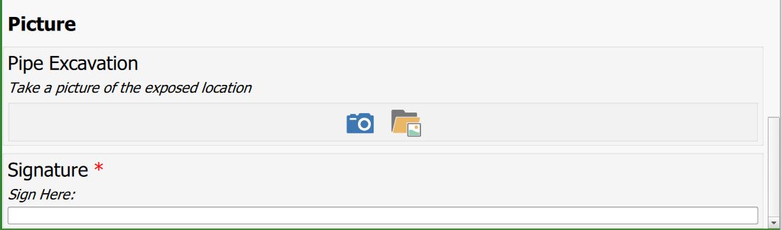
Finally, we need the ability to capture a picture and add a users signature. These are easily added to the survey as two rows within the XLSForm. The user can either select a picture from the device or launch the device’s camera and snap a picture. Both the signature and picture are saved as attachments and published back to the enterprise GIS.
Other options to complement the Verifiable, Traceable, Complete and Reliable requirements include auto-populating usernames, attaching additional documentation, notating field contractors and more.
The entire demo pipe excavation form we created totaled 32 rows in the XLSForm. It is by far the easiest tool I’ve seen on the market to implement pipeline specific field workflows. Once the form is complete, the administrator publishes the form and makes it available to the assigned groups or users in the field.
When you publish a survey in Survey123 Connect, a feature service is created using the schema from your survey. Your users will log on to the Survey123 application and can now download the new forms to their individual devices.
At this point, they are ready to hit the field and collect information! Each time a user edits or creates new features, it will write back to this unique feature service tied to the form. Other Esri applications like Workforce or Navigator can easily be integrated with Survey123 and will allow operators to assign work to specific users, get directions to the site, track progress and successfully push back gathered data to the enterprise GIS.
Survey123 is definitely a game changer in how pipeline operators will collect this type of data and other workflows in the field. Let SSP know if we can help you implement these tools and streamline your field collection workflows!

Chuck Kanoy says:
Excellent article and information for the next level process improvements for all forms of operational needs to capture data surrounding the pipeline assets and corresponding attributes for TVCR requirements.